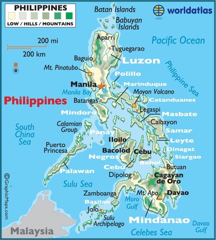
Map of The Philippines
The Philippines lies approximately 800km away from the southeast coast of Asia and is surrounded by the Philippine, South China, Sulu and Celebes seas. The Philippines is considered an archipelago as it is made up of a total of 7,107 islands, 400 of these being inhabited. There are 11 main islands that make up 95% of the total land area. The capital city of the Philippines is Manila. 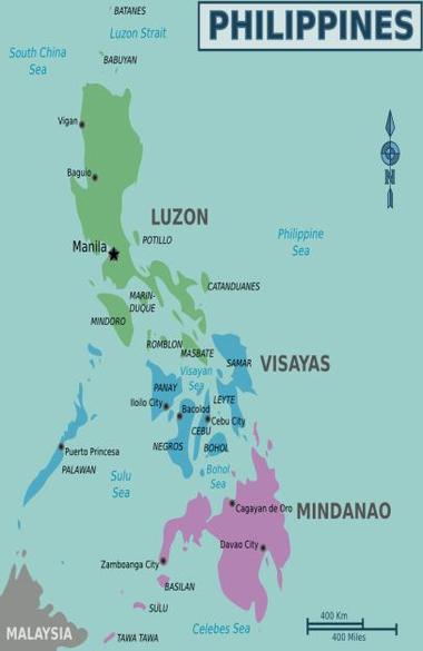
Island groups of The Philippines These islands are then put into three main island groups, Luzon, Visayas and Mindanao. Luzon: Found in the north, this group is mainly made up of two large islands, Luzon (which the island group is named after) and Mindoro. These islands are said to be the most significant when it comes to government, history and economy. Visayas: Located between the Luzon and Mindanao groups, the Visayas is made up of about 7,000 small islands. They are known as the centre of the countries nature, biodiversity and beaches. Mindanao: Known for its rich culture and Indigenous groups, this island group of Mindanao is made up of the remaining islands and is named after the second largest island in the Philippines that is in this island group. It is located in the southernmost part of the Philippines. 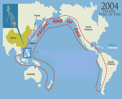
The Philippines in the Ring Of Fire
Due to its position in the Ring Of Fire, the Philippines is mostly made up of volcanoes and islands that are formed by volcanoes. 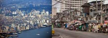
Manila
The most densely populated city in the world, Manila is the capital city and the second largest city in the Philippines. There are almost two sides to the city, one is the many lush hotels, tourist attractions, historical and traditional sites and sky scrapers that the city centre has. However, the other side to Manila is quite opposite, many people struggle to make a good living and are therefore forced to stay in unsanitary and crowded villages with a small shack and hardly any money. |
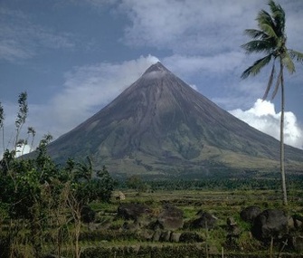
Mayon Volcano
Out of all Philippine volcanoes, Mayon is the most active. Reaching 2462m, it has large slopes and is very symmetrical. Since 1616, it has erupted a total of 47 times. 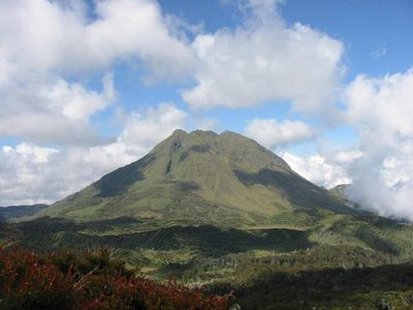
Mount Apo
Reaching a height of 2,954m, Mount Apo is the highest point of the Philippines and includes three different peaks. It is situated in south-central Mindanao and is an active volcano, despite the fact that the last eruption is unknown. Covered in a forest, it is home to native animals including the Philippine Eagle. 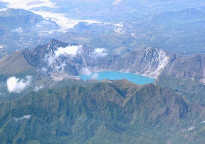
Mount Pinatubo
Mount Pinatubo is a major volcano in the Philippines located in Luzon. Its last eruption occurred in 1991 and was the second largest in the 20th century. It caused volcanic ash to enter into the atmosphere and as a result, lowered the Earth’s temperature for a few years. 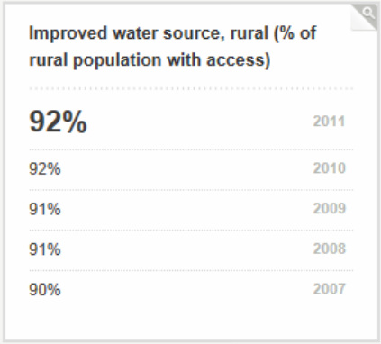
Sources Of Drinking Water
The Philippines relies on various sources of water for drinking, including rainfall, lakes, reservoirs and groundwater resources. It also relies on its 18 major river basins and 421 principle river basins. Groundwater sources are available in many different cities in the Philippines and combined, the area of groundwater is 50,000km2. Also, the Philippines receive significant rainfall year long and the total amount of freshwater resources is 145,900 million cubic metres a year. Although this seems like a good amount of drinking water supplies, many water sources are heavily polluted and therefore undrinkable or lead to various diseases. However, the quality of drinking water is improving in rural areas over time. 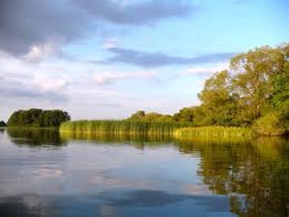
Laguna de Bay
Commonly referred to as Laguna Lake, Laguna de Bay is the largest lake in the Philippines. It is located in Luzon and with an area of 900km2, the lake passes through 9 cities. Although it is threatened by pollution, it is filtered and used as a major drinking source as well as for farming. 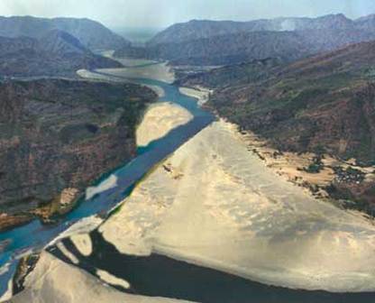
Cagayan River
The Cagayan River is the largest river in the Philippines and has an area of 25,469km2. Located in North Luzon, it serves as a major water source for farms that grow major crops such as rice and corn. |
